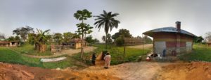
The first archaeological field mission, carried out by Dirk Seidensticker and Katharina Jungnickel, in close collaboration with Clement Mambu, Jeanine Yogolelo and Roger Kidebua (IMNC) during the summer of 2018, covered the western half of the former Bandundu province (current Kwango, Kwilu and Mai-Ndombe provinces) of the Democratic Republic of the Congo, an area largely unexplored by archaeologists. The aim of this mission was to conduct an initial survey between the Congo, Kwango and Kasai Rivers.

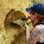
To compensate for the lack of any systematic and well-documented research in the area, the fieldwork was preceded by a perusal of the archives at the Royal Museum for Central Africa in Tervuren, which highlighted the rich potential of one specific site: Mukila (Kwango province). Maurice Bequaert excavated this site located some 250 km to the east of Kinshasa on the southern margins of the Bateke plateau in the early 1950s. There, he uncovered both stone tools and ceramics, possibly pointing towards the coexistence of hunter-gatherers and early sedentary communities. As Bequaert’s excavation was only poorly documented (multiple sketches and some photographs) and not published in any detail, we chose Mukila as our first priority target. Thanks to the available photos from the early 1950s and with the help of locals, we relocated two of Bequaert’s trenches. Our first test trench had to determine the quality of finds as well as the visibility and occurrence of features. We subsequently test-cored the site and opened a second 1.5 by 4.5 m large trench on a spot close to Bequaert’s richest excavation where we found promising finds during the coring as well. We excavated it up to 3.6 m, using 75x75x20 cm units. In total 126 units were systematically dry-sieved for small finds. Finds consisted of a rich mixture of pottery and stone tools. At the bottom of the profile we added another 3 m by extracting two additional cores resulting in a 6.6 m deep sequence. We systematically sampled the cores and the profile for paleo-environmental remains.


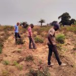
After our excavations at Mukila we conducted a detailed and first-ever survey along the dirt roads between the towns of Mongata, Masia-Mbio and Bandundu, a 300 km long stretch between the Congo and Kwango rivers. We surveyed 62 distinct areas corresponding to roughly 11 hectares in total. Besides surveying areas currently used for agriculture, mainly the cultivation of manioc, we also looked at borrow pits created for the construction of the dirt roads. These borrow pits were of special importance as they allowed us to review existing profiles and thus uncover cultural layers invisible to surface surveying only. Two very large borrow pits in the vicinity of Bandundu town yielded a vast collection of stone tools both on the surface and in the extant profile. A variety of half-finished and elaborately done bifacial points as well as large amounts of flakes and chips were scattered within the pits, sometimes forming small concentrations. At the second pit some potsherds were scattered on the surface as well. We extracted botanical samples for paleo-environmental research from the extant profiles of both pits and retrieved charred remains through flotation. While doing so, we discovered a thin layer of lithic flakes and chips, which might be the remains of one single knapping event.
Finally, we identified several fields rich in pottery finds close to the town of Bandundu. These ceramics represent quite some stylistic and technological diversity, possibly of both local and external origin.